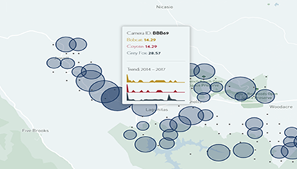
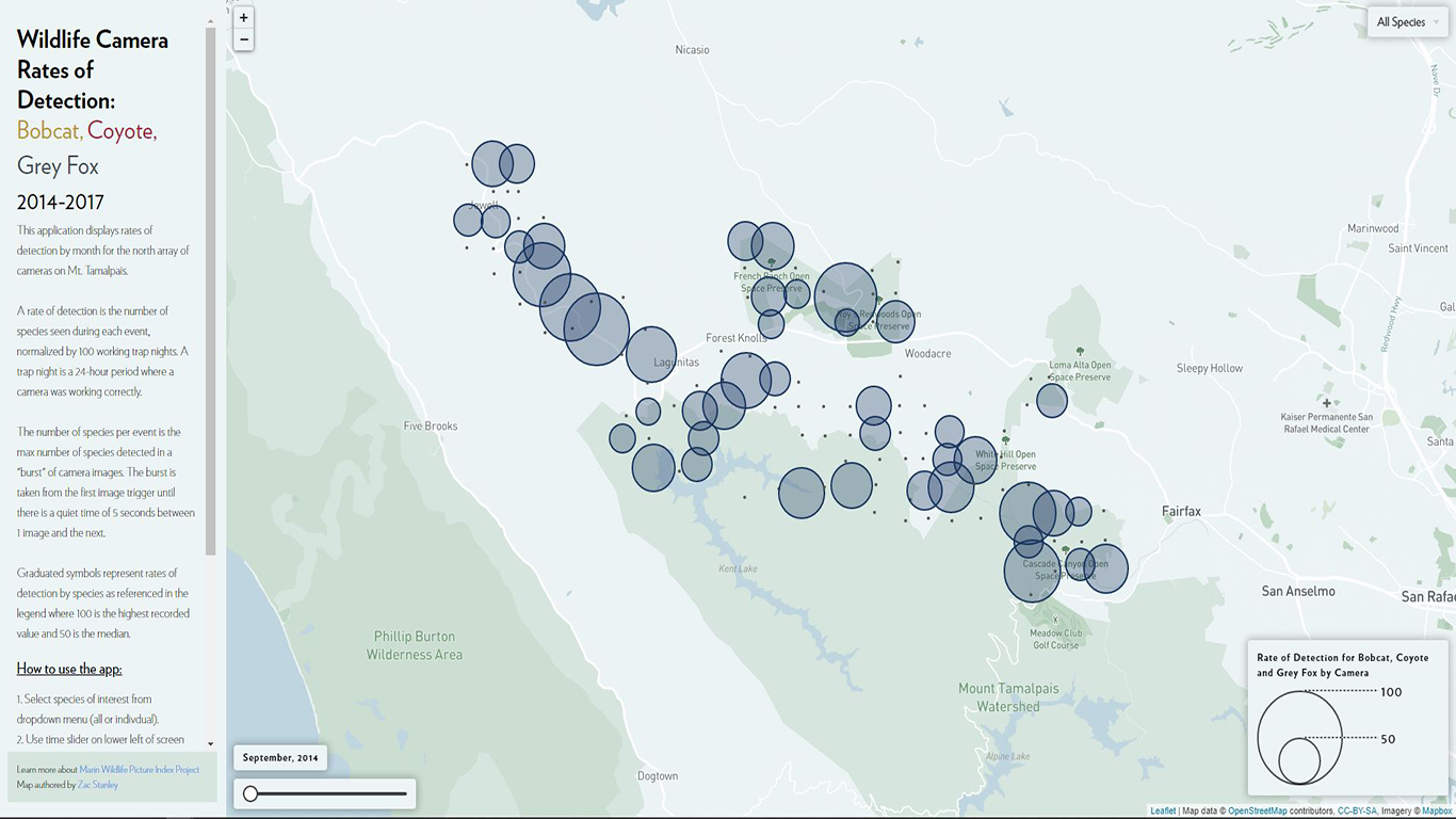
Wildlife Cameras
This tri-variate graduated symbol map shows wildlife camera rates of detection for three meso-carnivore species (bobcat, coyote, and grey fox) in Marin County California from 2014-2017.

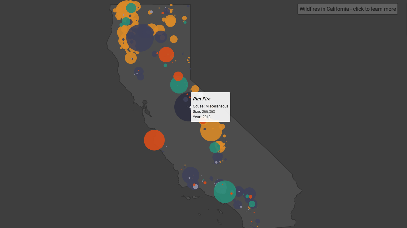
Wildfires in California
This bivariate map represents wildfires in California from 2009-2019. The symbol size represents size in acres >= 100 and the colors represent the five most common cause of fire during this time period. The data came from the U.S. Forest Service; FIRESTAT Fire Occurrence - Yearly Update.
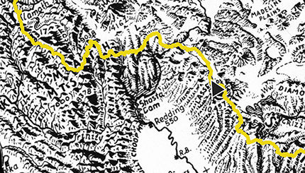
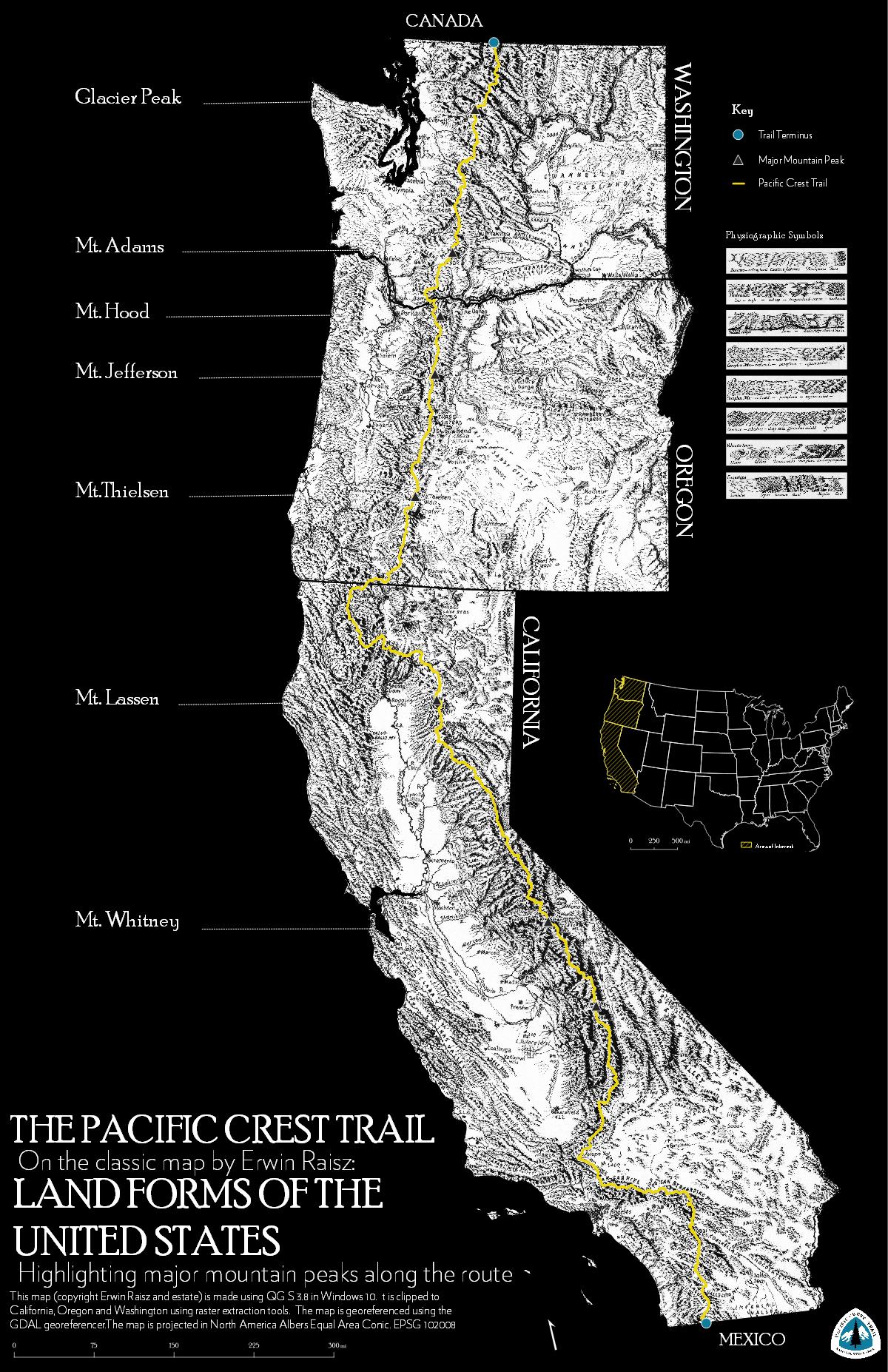
Pacific Crest Trail Peaks
This map shows the Pacific Crest Trail from Mexico to Canada, and highlights the major mountain peaks along the route. It is overlaid on a geoferenced version of the classic Erwin Raisz Landforms of the United States Map.
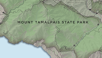
Mount Tamalpais State Park Trails
Map of Trails in and around Mount Tamalpais State Park in Marin County, California. The map is intended for use by the State Park trail crew to manage trail projects.
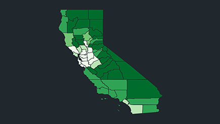
Open Space in California
This choropleth map represents percentage of open space by acres in California by managing agency type: Federal, State, County or Land Trust. The data are derived from the California Protected Areas Database (CPAD)
Evolving Shorelines Story Map
Story map of Bothin Marsh Open Space Preserve focused on telling the story of how the community can adapt to Sea Level Rise while saving habitat through nature based solutions.

Golden Gate National Recreation Area - Northlands Trails
Map of Trails on park units in the northern Golden Gate National Recreation Area. Each unit is stands alone in orientiation but shares a common scale of 1:10000. Uses Eduard Imhof basemap style. Created in ArcGIS Pro 2.6.
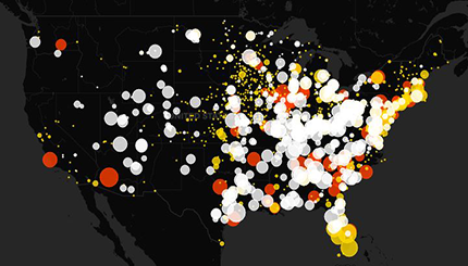
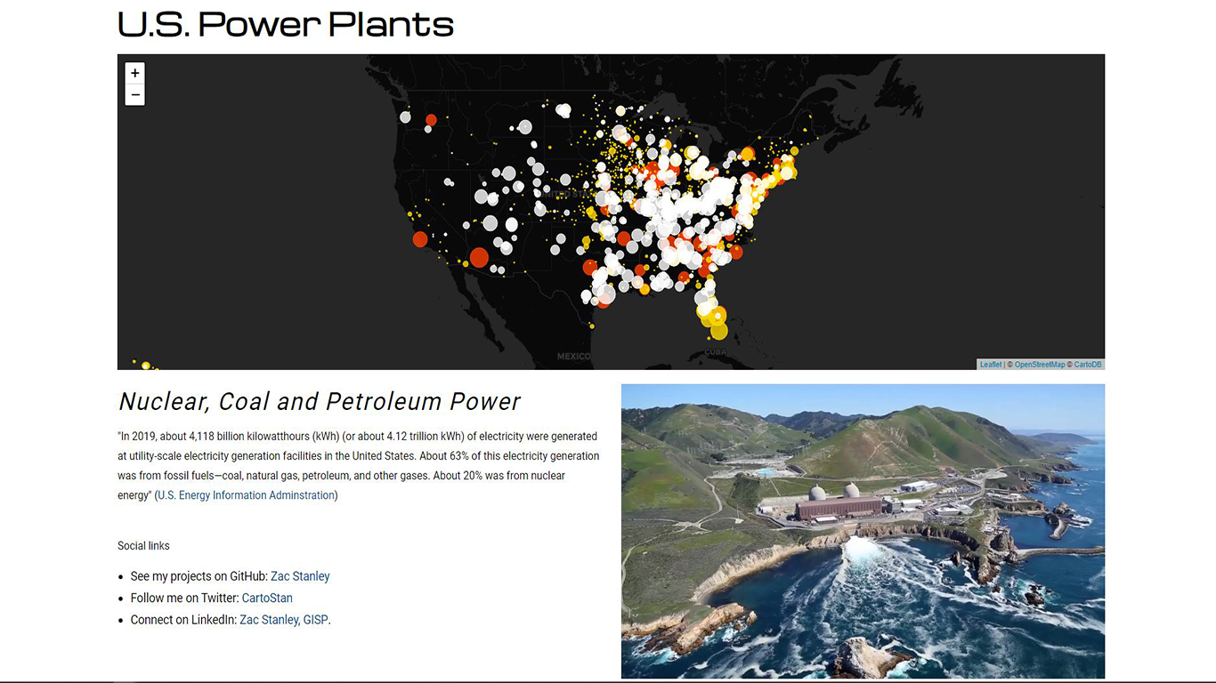
United States Power Plants
This bivariate map shows power plants in the United States using graduated symbols to show total power capacity in megawatts and color to describe the primary source of power; Nuclear, Coal or Petroleum.
 United States Power Plants
View project
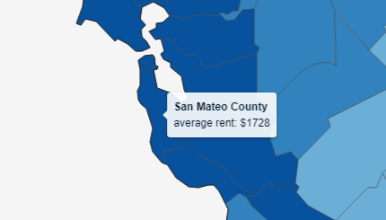
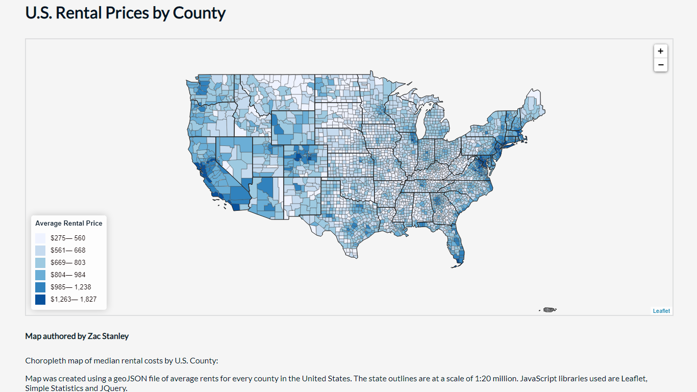
Rental Costs - United States
This choropleth map details median rents for every county in the United States.
 United States Power Plants